Once famed for its trade, plentiful fishing grounds, and vast quantities of oil and natural gas, the South China Sea is today more recognized as a chessboard in the conflict between the United States and China.
China’s maritime military buildup is happening at the cost of other countries in the area with competing territorial claims. The United States adds fuel to the fire by backing established friends and international norms.
1.35 Million Square Miles
It’s not easy to pinpoint an exact position for the South China Sea. Vietnam’s coastline shares this body of water with that of China, the Philippines, Brunei, Malaysia, and Taiwan. That the sea’s boundary is shared by several nations is both its defining geographical characteristic and its primary source of conflict. All six nations lay claim to different areas of the ocean, and several also have territorial claims to the many islands, reefs, and shoals that dot the area.
The Paracel Islands are located to the north of the Spratlys and are closest to Vietnam, China, and Taiwan; the Spratly Islands are located to the east and are closest to the Philippines, Malaysia, and Brunei.
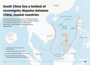
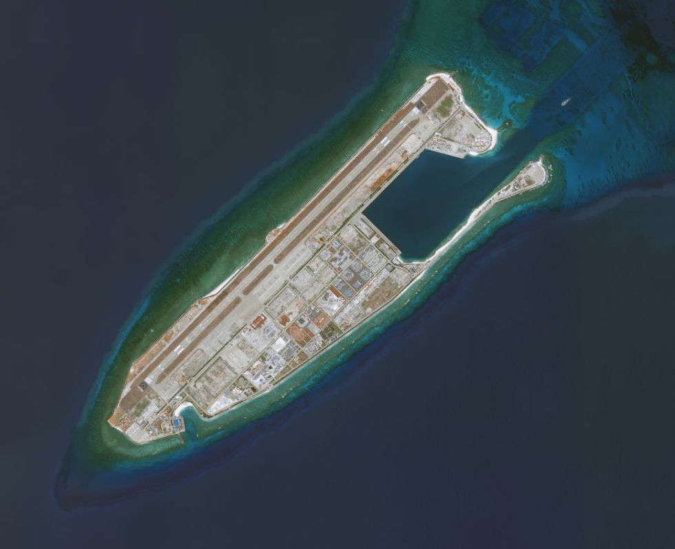
Until China’s recent actions, no country has actively pursued territorial claims in the South China Sea. China claims 90% of the 1.35 million square mile sea, whereas other nations in the area often claim just a small portion. And it has been much more forceful than any other nation in recent decades in driving out its neighbors.


